Ugasan:East Timor adm location map.svg

Ungkuran na tingkos (Berkas SVG, nominal 1,701 × 1,050 piksel, balga ni surat partadingan: 72 KB)
Panimpulan
| Deskripsi |
Deutsch: Positionskarte von Osttimor
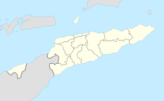
English: Location map of East Timor
|
||||||||||||
| Tanggal | |||||||||||||
| Mualna |
Own work using:
|
||||||||||||
| Panompa | NordNordWest | ||||||||||||
| Other versions |
|
||||||||||||


|
This map has been made or improved in the German Kartenwerkstatt (Map Lab). You can propose maps to improve as well.
|
Ragam ni lisensi
Usage of this file with:

explanatory notes: Legally binding is only the full legalcode. For a free usage I recommend to respect the following licence conditions:
1. Provide my name as given above: NordNordWest,
2. a copy of, or the URI for, the applicable license: https://creativecommons.org/licenses/by-sa/3.0/de/legalcode,
3. the title of the work,
4. in the case of an adaptation, a credit identifying the use of the work in the adaptation.
This license and the rights granted hereunder will terminate automatically upon any breach by you of the terms of this license. Any of the above conditions can be waived if you get permission from the copyright holder. If you have questions or wish differing conditions, please contact me through nnwest or my discussion page ![]() t-online.de
t-online.de
- Boi do hamu:
- marbagi – Mangganti dohot paserakhon muse angkup ni tulisan on ni bagas rumang manang aha pe
- mangose – Mangadaptasi sikarejoan on
- Marbingkas hatontuon marihut
- atribusi – Ingkon dibahen hamu do panjangkonon na une, mangalehon pangait tu pasiathon jala paboahon manang adong hamubaon. Boi do dibahen hamu marhitehite dalan na pinillit ni hamu sandiri, alai ndang manatahon ala na mangalehon pasiat surat isin na mangalophon hamu manang pambahenan ni hamuna
- marsagi tudos – Molo naeng manguba manang mambahen na asing sian guritan on, hamu ingkon pararathon pambahenanmuna i di toru ni same or compatible license songon asli na.

Jujur ni ugasan
Piltik di sada tanggal/pukul laho mangida ugasan on di tingki i.
| Tanggal/Pukul | Metmetna | Dimensi | Sipanghasea | Hata panambai | |
|---|---|---|---|---|---|
| saonari | 14:55, 9 Agustus 2017 | | 1,701 × 1,050 (72 KB) | NordNordWest | == {{int:filedesc}} == {{Information |Description= {{de|1=Positionskarte von Osttimor}} {{en|1=Location map of East Timor}} {{Location map series N |stretching=101 |top=-7.8 |bottom=-10.0 |left=123.9 |right=127.5 }} |Source={{Own using}} * United State... |
Parhaseangon ni ugasan
Ndang adong alaman na marpangait tu berkas on.
Parhaseangon ugasan na global
Wiki na asing manghaseanghon ugasan on:
- Parhaseangon di de.wikipedia.org
- Parhaseangon di hu.wiktionary.org
- Parhaseangon di id.wikipedia.org